Bordering Countries MCQ Practice Questions
Ques: 1
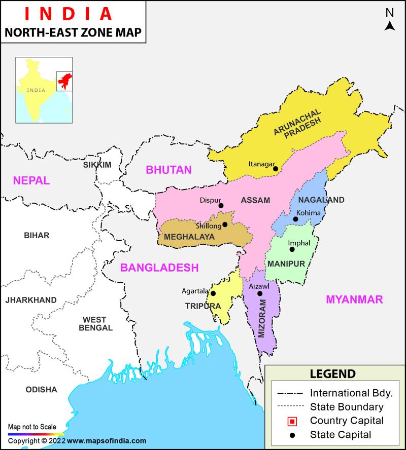
Consider the following statements:
- Assam shares border with Bhutan and Bangladesh.
- West Bengal shares border with Bhutan and Nepal.
- Mizoram shares border with Bangladesh and Myanmar.
- Which of the statements given above are correct?
Ques: 2
Extension of the International boundaries of India along with their neighbouring countries in ascending order are
Ques: 3
Which one of the following states does not form the border with Bangladesh –
Ques: 4
Which one of the following Indian states does not share border with Bhutan?
Ques: 5
Which one of the following Indian states does not share border with Nepal?
Ques: 6
Which of the following Indian state shares maximum boundary with Myanmar?
Ques: 7
Which of the following states of India does not have a common border with Myanmar?
Ques: 8
Which one of the following countries share the longest land frontier with India?
Ques: 9
Which of the following states does not form its boundary with Bangladesh?
Ques: 10
The boundary between India and Pakistan was demarcated by:
Ques: 11
The boundary line between India and Pakistan is an example of
Ques: 12
What is Radcliffe line?
Ques: 13
Which State of India has borders with three countries namely Nepal, Bhutan and China?
Ques: 14
Which one of the following states of India has an international boundary on its three sides?