Whatsapp 88106-52225 For Details
Get Free IAS Booklet
Get Free IAS Booklet
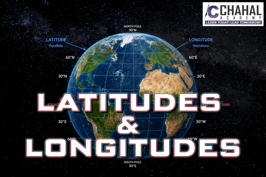
LATITUDES & LONGITUDES
LATITUDE
Latitude is like the horizontal lines on a map that tell you how far north or south a place is from the Equator. The Equator is the starting point and it’s at 0 degrees latitude. As you move north or south from the Equator, the latitude increases, reaching a maximum of 90 degrees at the North and South Poles. So, latitude helps us understand locations in terms of their distance from the Equator.
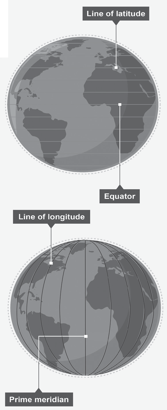
Latitude is measured in degrees, like the lines on a ruler. Each degree of latitude is about 111 kilometers (around 69 miles) long on the Earth’s surface. If we break down a degree into smaller parts, we get minutes and seconds. There are 60 minutes in a degree, and each minute is about 1.85 kilometers (or 1.15 miles) long. Further, each minute can be divided into 60 seconds. A second of latitude is quite small, covering only about 30.7 meters (around 100 feet) on the Earth’s surface. So, seconds of latitude are very tiny compared to degrees and minutes.
Some Important lines of latitudes on the Earth
• Equator (Latitude 0o)
• Tropic of Cancer (Latitude 23.5oN)
• Tropic of Capricorn (Latitude 23.5oS)
• Arctic Circle (Latitude 66.5oN).
• Antarctic Circle (Latitude 66.5oS).
Here are some key things to know about latitudes
• Except for the equator, all latitudes are like rings around the Earth, getting smaller as they move away from the equator.
• Latitudes never cross each other; they always stay parallel.
• They form lines that run from east to west across the globe.
• Latitudes play a big role in deciding what the weather is like in different parts of the world.
LONGITUDE
Lines of longitude, known as meridians, are imaginary lines that go from the North Pole to the South Pole. They measure how far east or west a place is. The starting point for measuring longitude is the prime meridian, which goes through Greenwich, England and has a longitude of 0 degrees. This line splits the Earth into the eastern and western halves.
• On the opposite side of the Earth, there’s the antimeridian, at 180 degrees longitude. It’s where the international date line is based, but actual time zones and date boundaries can vary based on local rules. The international date line doesn’t follow a straight path but bends around borders near the antimeridian.
Two Important Lines of longitude
• Prime Meridian = Longitude 0o (Greenwich Meridian).
• International Date Line (Longitude 180o).
Here are some important characteristics of longitudes
• Each longitude line is like half of a big circle that goes from the North Pole to the South Pole.
• They run straight up and down, from the top of the Earth to the bottom.
• Longitudes are farthest apart at the equator and come close together as they approach the poles.
• Longitudes help us figure, what time it is in different parts of the world, helping to determine standard time zones.
The International Date Line
The International Date Line (IDL) is an imaginary line on the Earth’s surface that marks, where one day ends and the next begins. It’s located approximately at 180 east or west of the prime meridian, which runs through Greenwich, UK. The IDL passes through the Pacific Ocean and doesn’t run straight but zigzags to avoid splitting countries into different calendar days.
It bends near the Bering Strait between Siberia and Alaska, as well as around islands like Fiji and Tonga.
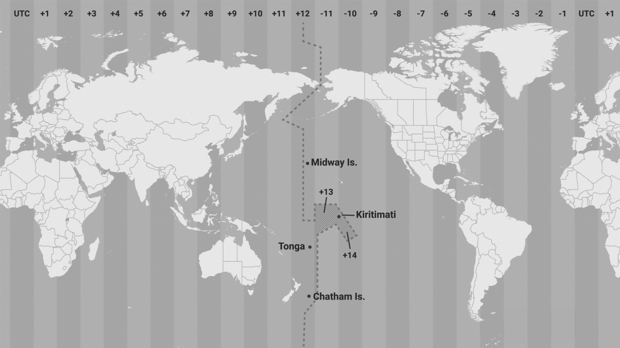
(Fig- International Date Line passing through the Pacific Ocean)
Note: The reason why the 180 meridian was chosen for the International Date Line is, because it mostly goes through the empty parts of the Pacific Ocean where few people live. This decision was made in 1884 at a meeting called the International Meridian Conference in Washington, D.C.
At the International Date Line, each new day begins at midnight. When you cross this line, you have to change your date. If you’re traveling from the west to the east (like from the USA to Japan), you suddenly jump forward a day. For example, if it’s Monday at 6 a.m. in the USA, when you cross the line into Japan, it becomes Tuesday at 6 a.m. However, if you’re traveling from the east to the west (from Japan to the USA), you actually lose a day. So, if it’s Tuesday at 6 a.m. in Japan, when you cross the line into the USA, it becomes Monday at 6 a.m.
Time Zones
The world is divided into 24 time zones, each representing one hour of the day. These time zones are like slices around the globe, running vertically from north to south. To keep time consistent worldwide, we use Coordinated Universal Time (UTC), which acts as a reference point. It helps regulate time and date across different regions, making sure everyone is on the same page.
• The world is divided into time zones based on longitude. There are 360 degrees of longitude around the Earth, and each day is divided into 24 hours.
• So, if we divide the total number of degrees of longitude by the number of hours in a day, we get roughly 15 degrees per hour (360 degrees divided by 24 hours). This means that each hour difference in time, corresponds to roughly 15 degrees of longitude.
• France, has the most time zones among countries, with 12 zones. This is mainly because of its various territories scattered around the world.

Standard Time Zones
The Earth takes 24 hours to complete one full rotation on its axis. Since Earth has 360 degrees of longitude, it means that for every hour that passes, a point on Earth moves through 15 degrees of longitude (360 divided by 24 hours).
If we break it down further, for every 4 seconds that pass, a point on Earth’s surface moves through 1 degree of longitude.
Indian Standard Time Zone
Indian Standard Time (IST) is the time zone used in India. It’s 5 hours and 30 minutes ahead of Coordinated Universal Time (UTC), which used to be called Greenwich Mean Time (GMT). This time zone is used in Asia.
What makes Indian Standard Time unique is that it’s a half-hour time zone. Usually, time zones differ by whole hours, but IST is different by 30 minutes. Indian Standard Time is based on a specific longitude of 82.5 , which passes through a place called Mirzapur, near Allahabad in the state of Uttar Pradesh, India.
Additional Information
A Great Circle, is like a big circle that goes through the center of the Earth, such as the Equator and all the lines of longitude (meridians). The shortest path between any two points on the Earth’s surface follows the arc of a Great Circle. Other circles that don’t pass through the center of the Earth, like lines of latitude other than the Equator, are called Small Circles. Great circles are helpful for planning routes because they show the shortest distances between places.
When you draw a crisscross pattern of lines of latitude and longitude on a map, it creates what’s called a Geographic Grid, also known as a Reference Grid or Graticule. This grid helps us pinpoint locations on Earth. Nowadays, we use a modern tool called the Global Positioning System (GPS) to determine locations accurately.