Flood Risk Mitigation
Understanding Disaster Risk
Modernization ofObservation Network ; Assessment, Monitoring and Scientific studies.
Preparation of large-scale hazard maps of flood prone areas of high vulnerability.
Studies and monitoring of rivers flowing from neighbouring countries
Research and Development:
River Basin Analysis: Conduct comprehensive studies on river basins to understand their hydrological and ecological dynamics.
Research on Flood-Related Issues: Investigate challenges such as soil erosion due to river flooding, sediment transportation, river course alterations,
and the effective utilization of embankments.
Encouraging Research Initiatives: Support both internal and external research by offering grants to institutions and researchers for in-depth studies on flood management.
Hydrological and Morphological Assessments: Conduct thorough evaluations before implementing any major flood prevention or control measures.
Hazard Risk Vulnerability Assessment
Flood Hazard Zonation is also an essential step for future flood disaster management. The probability that a flood of a certain intensity will occur over an extended period is determined. Flood hazard is mainly used to define flood-prone zones.
National Remote Sensing Centre (NRSC)/ISRO has taken up development of Flood Hazard Zonation Maps using satellite data towards Disaster Risk Reduction, in addition to flood response.
The flood hazard maps prepared from satellite data were peer reviewed by a Committee constituted by National Disaster Management Authority (NDMA), which includes CWC (Central Water Commission), IMD (India Meteorological Department) and SDMA (State Disaster Management Authority).
Monitoring, Forecasting and Warning Systems
Dissemination of warnings, data, and information
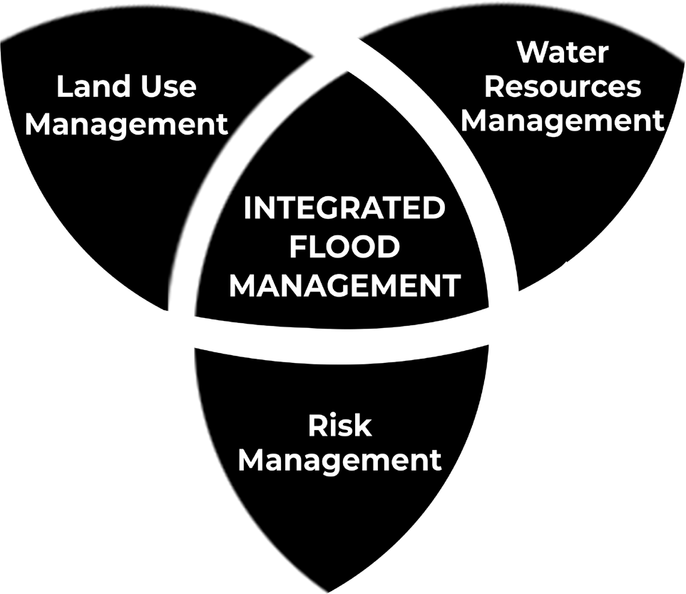
Figure: Integrated Flood Management
Integrated flood management (IFM):
It calls for a paradigm shift from the traditional, fragmented and localized approach, and encourages the use of the resources of a river basin as a whole, employing strategies to maintain or augment the productivity of floodplains, while at the same time providing protective measures against losses due to flooding.
Since IFM is essentially a dynamic notion, including emerging issues, such as risk management, urban floods, climate variability and change, and adaptive management.
IFM is holistic approach derived from Integrated Water Resources Management (IWRM) principles that stresses the interrelationship between socio-economic development, environmental sustainability and flood-risk management.
Inter-Agency Coordination: Inter-agency coordination is a key component of strengthening disaster risk governance. It is required among both central and state agencies in the field of Overall disaster governance, Response, Warnings, Information and data sharing and Non-structural measures.
Investing in DRR–Structural Measures
Identification of Safe Shelters: Locate secure buildings and sites to serve as temporary refuges for both people and livestock evacuated from flood-prone areas.
Construction of Multi-Purpose Cyclone Shelters: Build shelters in coastal villages and habitations that are frequently affected by cyclones to provide safety during disasters.
Maintenance of Drainage Systems and Embankments: Ensure proper upkeep of drainage networks and flood embankments to mitigate waterlogging and flood risks.
Incorporation of Flood-Resistant Features: Integrate flood-resistant designs in the planning and execution of social housing projects in flood-prone regions.
Implementation of Flood Safety Measures: Enhance safety and minimize flood risks through strategies like catchment flood modeling.
Pre- and Post-Monsoon Inspections: Conduct regular assessments of dams and reservoirs to identify vulnerabilities and implement necessary reinforcements.
Monitoring Safety Enhancements: Ensure that all safety improvement measures are effectively executed as per prescribed standards.
Desilting and Dredging of Rivers: Improve water flow by removing excess silt, enhancing drainage, and diverting floodwaters through existing or newly constructed river channels.
Hazard-Resistant Construction and Infrastructure Strengthening: Strengthen and retrofit lifeline structures and critical infrastructure to enhance resilience against floods and related disasters.
Investing in DRR–Non-Structural Measures
Implement regulations for land use in low-lying areas in accordance with flood control guidelines.
• Regulate habitation in low-lying zones along rivers, streams, and drainage systems to reduce flood risks.
• Ensure the effective implementation of a comprehensive plan to manage and mitigate floods.
• Periodically assess and revise operational guidelines for all major dams and reservoirs to enhance flood preparedness.
• Prevent and remove encroachments that obstruct natural water channels and drainage systems.
• Update and enforce relevant policies and regulations in flood-prone areas to minimize risks.
• Restrict activities that involve reclaiming wetlands and natural low-lying areas to maintain their role in flood control.
• Develop and implement strategies to protect wetlands and natural drainage systems to aid in flood moderation.
• Implement watershed management practices, including catchment area treatment and afforestation, to reduce flood risks.
• Promote involvement of private entities in disaster management infrastructure and facilities.
Capacity Development
• Training Programs for Government Staff and Professionals: Conduct orientation sessions on veterinary care and support for animals affected by disasters.
• Integration of Disaster Response in Youth Training: Include search and rescue operations in training programs for village volunteers and youth, with a focus on protecting disaster-affected animals.
• Curriculum Revision for Engineering Courses: Update undergraduate engineering syllabi to cover flood hazard mitigation and disaster-resistant construction techniques.
• Encouragement of Emergency Drills: Facilitate planning and execution of emergency drills across all ministries and States/UTs.
• Skill Development for Disaster-Resistant Construction: Provide training in building multi-hazard-resistant infrastructure, particularly in flood-prone areas.
• Public Awareness Campaigns: Utilize mass media, community radio, and other platforms to enhance disaster preparedness awareness.
• Gender-Sensitive and Inclusive Capacity Building: Ensure disaster management strategies incorporate gender equity and social inclusion at all levels.
• Community Disaster Preparedness: Strengthen local communities’ ability to manage and respond to disasters through a multi-hazard approach.
• Training for Local Organizations and Volunteers: Conduct training for panchayat members, SHGs, NCC, NSS, youth, and other community organizations to enhance disaster response skills.
Steps Taken to Mitigate Floods
Establishment of Rashtriya Barh Ayog (RBA): The National Flood Commission was formed by the Ministry of Agriculture and Irrigation in 1976 to assess India’s flood control measures after the National Flood Control Program of 1954 yielded limited success.
Financial Assistance for Flood Management: The Central Government has been funding flood control efforts under the Flood Management Programme (FMP) since the XI Plan.
Following initiatives have yielded significant results :
• National Flood Management Framework: A structured approach to flood mitigation and preparedness.
• Hydro-Meteorological Data Policy: Ensuring efficient dissemination of flood-related data for better decision- making.
• Deployment of Mobile Pump Units: Used during Delhi floods to manage waterlogging and mitigate flood impact.
• ‘Flood Watch’ Mobile Application: Provides real-time flood-related updates to enhance preparedness and response.
During X Plan, following four schemes were sanctioned to provide central assistance to the flood prone states to take up flood control and river management works in critical areas:
• Critical Anti-erosion works in Ganga Basin States (a Centrally Sponsored Scheme)
• Critical Flood Control and Anti Erosion Schemes in Brahmaputra and Barak Valley States (a State Sector Scheme),
• Improvement of Drainage in critical areas in the country (a State Sector Scheme)
• Critical Anti-erosion Works in Coastal and other than Ganga Basin States (a State Sector Scheme).
River Management Activities and Works Related to Border Areas (RMBA)
• During XI Plan, Government of India had approved implementation of the Central Sector Scheme “River Management Activities and Works related to Border Areas” for taking up non-structural measures such as Hydrological Observation and Flood Forecasting works on common border rivers, payment to neighbouring countries (China) for supplying HO data on common rivers, investigation of WR projects in neighbouring countries, activities of GFCC and Pancheswar Development Authority (PDA) was funded through this scheme.
• In addition to above activities, 100% Central Assistance was also provided for taking up structural measures such
as Anti Erosion/Flood Management schemes on rivers on international borders and Union Territories.
National Commission for Water Resources (1999):
• It suggested that storage dams and embankments provide effective protection to flood-prone areas and an urgent need to enact the flood plain zoning Act.
National Water Policy (2012):
• Formulated by the Ministry of Jal Shakti with the objective to take cognizance of the existing flood situation and to propose a plan of action from the national perspective. It suggested that through reservoir operation, the flood cushion can be set up to reduce the trapping of sediment during the flood season.
National Hydrology Project (2016):
• It is a central sector scheme under the Ministry of Water Resources, River Development & Ganga Rejuvenation; with 50% of the outlay amount received from the World Bank loan. The project gathers hydro-meteorological data which will be stored and analyzed on a real-time basis and can be accessed by any user at the State, District, and Village level.
Flood Plain Zoning
• Flood-plain zoning is a concept central to flood plain management. This concept recognises the basic fact that the flood plain of a river is essentially its domain and any intrusion into or developmental activity therein must recognise the river’s ‘right of way’.
• Flood-plain zoning measures aim at demarcating zones or areas likely to be affected by floods of different magnitudes or frequencies and probability levels, and specify the types of permissible developments in these zones, so that whenever floods actually occur, the damage can be minimised, if not avoided.
• The Central Water Commission (CWC) has been continuously impressing upon the states the need to take follow-up action to implement the flood plain zoning approach.
• A model draft bill for Flood Plain Zoning Legislation was also circulated by the union government in 1975 to all the states.
• There has been passive resistance on the part of the states to follow up the various aspects of flood plain management including possible legislation.
Flood Proofing
• Flood proofing measures adopted in India in the past, consisted in raising a few villages above pre-determined flood levels and connecting them to nearby roads or high lands.
• Under this programme, several thousand villages were raised in Uttar Pradesh in the fifties. In West Bengal
and Assam also land-fills were attempted in villages to keep houses above flood levels even though nearby agricultural lands were liable to inundation.
• During X Plan, the Government of Bihar had also constructed, with Central assistance, the raised platforms for safety of the people in flood prone areas of North Bihar.
CWC National Flood Forecasting Network
• Flood Forecasting and flood warning in India was commenced in a small way in the year 1958 with the establishment of a unit in the Central Water Commission (CWC), New Delhi, for flood forecasting for the river Yamuna at Delhi.
• Presently, there are 878 Hydrological and Hydro- meteorological sites being operated by CWC across the country covering 20 river basins for gauge, discharge, sediment & water quality observations.
• The formulation of a forecast requires effective means of real time data communication network from the forecasting stations and the base stations (380 nos approx at present).
• Flood Foreasting system comprises of Level Forecasting and Inflow Forecasting.
• The Level Forecasts help the user agencies to decide mitigating measures like evacuation of people and shifting people and their movable property to safer locations.
• The Inflow Forecasting is used by various dam authorities in optimum operation of reservoirs for safe passage of flood downstream as well as to ensure adequate storage in the reservoirs for meeting demand during non-monsoon period.
Watershed Management
• The watershed management measures include developing and conserving the vegetative and soil covers and also to undertake structural works like check- dams, detention basins, diversion channels, etc.
• In the watershed management of upper catchment, land treatment through afforestation and grass land development practices should be supplemented by structural works for retarding the water velocity and arresting silt.
Community based Management
The Intergovernmental Oceanographic Commission (IOC) of UNESCO has started a community performance- based programme known as “Tsunami Ready” for the promotion of tsunami preparedness by actively involving the public, community leaders, and national and local emergency management agencies.