THE CITY
Water Resources
The geographical setting of Vijayanagara, nestled within the basin formed by the Tungabhadra River, is accentuated by surrounding granite hills that encircle the city.
Numerous streams stemming from these rocky formations feed into the river, and embankments were strategically constructed along these streams to create reservoirs of varying sizes.
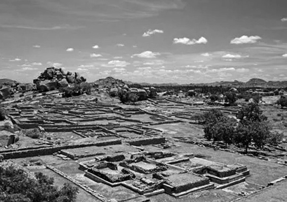
Due to the region’s arid nature, elaborate systems were developed to collect and store rainwater.
• Among these initiative, the construction of the Kamalapuram tank stands out, which was commissioned by Vijayanagara king Devaraya II. Stands out. This significant tank, dating back to the early 15th century,served the dual purpose of irrigating nearby fields and channeling water through a system that reached the “royal center” of the city, ensuring a consistent water supply.
• Another remarkable water management structure, the Hiriya canal, is a prominent feature among the ruins of Vijayanagara. This canal was designed to draw water from a dam built across the Tungabhadra River. Its primary function was to irrigate the cultivated valley that separated the “sacred center” from the “urban core” of the city. Historically attributed to the Sangama dynasty kings, this canal was a testament to the sophisticated water management systems of the empire.
Fortifications and Roads
• The Vijayanagara Empire’s fortifications were an awe- inspiring series of structures that enclosed not just the city but also its agricultural regions and forests.
• Impressively, Abdur Razzaq, a Persian ambassador in the 15th century, noted the existence of seven lines of forts, symbolizing a formidable defensive network.
• These massive walls were constructed with massive masonry, slightly tapered, and incredibly sturdy without the use of any mortar or cement. They consisted of wedge- shaped stone blocks held in place by their own weight. The walls’ inner sections were made of earth packed with rubble, with square or rectangular bastions projecting outward.
• What made these fortifications remarkable was their inclusion of agricultural lands within their boundaries. This was an unconventional strategy considering medieval sieges often aimed to starve defenders into submission by cutting off their food supplies. Abdur Razzaq observed cultivated fields, gardens, and houses between the first, second, and third walls, indicating a purposeful inclusion of agricultural tracts within the fortified area.
• The empire’s rulers opted for an elaborate and costly strategy by safeguarding the agricultural belt itself instead of merely storing provisions within the fortified areas. Evidence of an agricultural tract serviced by an intricate canal system supported by the Tungabhadra river was discovered between the sacred center and the urban core, reinforcing this strategic approach.
• The fortifications had multiple lines of defense encircling different sections of the city. A second line surrounded the inner core of the urban complex, while a third encircled the royal center, wherein each major building had its own high walls.
• The fortified city was accessible through well-guarded gates that connected to major roads. These gateways were not only points of entry but also distinctive architectural structures. The arches and domes on these gateways showcased elements of Indo-Islamic architecture, showcasing the influence of Turkish Sultanate styles blended with local building practices.
• Archaeologists have also identified roads within the city and leading outwards. These roads were traced through gateways and identified by remnants of pavements. Interestingly, some major roads extended from temple gateways and were accompanied by bustling bazaars, indicating a linkage between religious centers and commercial activities.